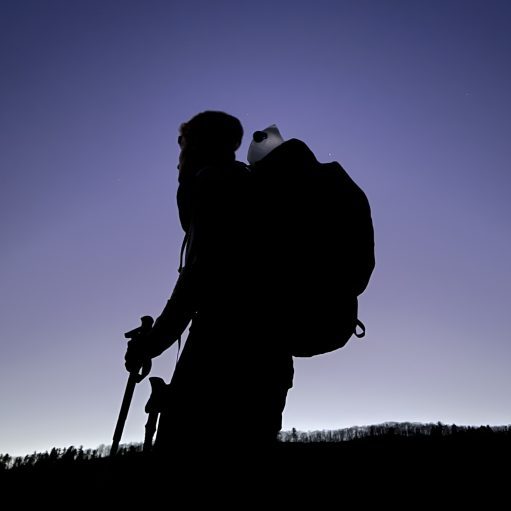
Date Written: 8/25/2024 | AT Mile 291.6 | Day Total: 17.4 miles | Gain: 5441 ft
Wanted to get an early start this morning so I set my alarm for 5:30. I camped right before the Mahoosuc Notch so I’ve got .3 miles to the beginning of that.
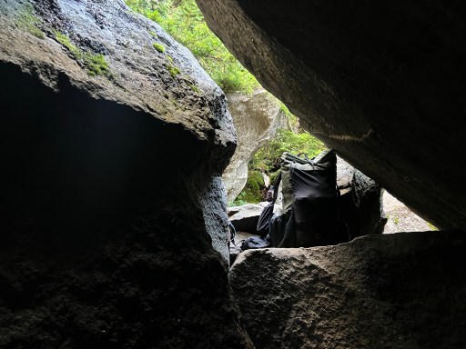
The Mahoosuc Notch is the most difficult mile on the AT. It actually .8 of a mile but they round up for simplicity. It’s primarily composed of massive rocks that are placed at odd angles. It known for its technicality as you have to squeeze around little nooks and hop across large deep gaps. It’s generally a slow rolling mile.
As I approached the Notch I was beginning to see large boulders around me. But it quickly turn into the beginning of the Notch. I started a stopwatch out of curiosity of how long it would take me to get through. I’ve heard that the girl going for the FKT (Fastest known time) of the AT this year got through it in 55min. But I have also been told that a gentleman and his dog took 7 hours to get through.
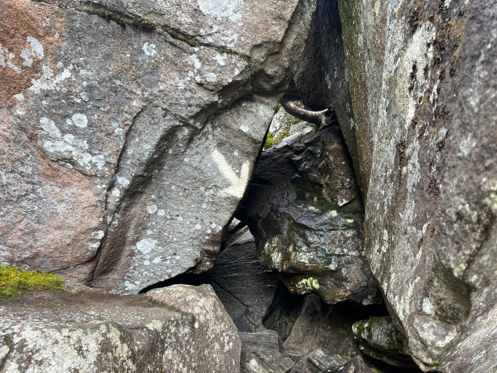
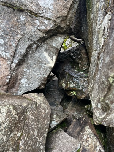
The rocks were massive as expected and required some thought as to navigating the easiest and safest way up/down. I had to squeeze into this little holes in the rocks that sometimes had a white arrow pointing into it. I had to take my pack off to fit through this one.

At a few points in the notch you could see the sides of the mountain. It was super pretty as the sun was still rising a bit.

Very technical and slow moving it was. I was having a lot of fun going through and its technicality reminded me of hiking on knifes edge just without the heights factor. The trail isn’t marked super well so it was hard to tell where to go at times.
Before I knew it the Notch came to an end. It went by faster than I expected. I only saw one other person that was going nobo when I was in the Notch. I had to take my pack off twice and it took 1hr and 7min to get through. It helps a lot to be young and have a small pack during sections like these – that’s what I’ve been told.
Where the Notch starts on the other side there were a few people about to head up not the Notch. There were two guys from Europe thru-hiking nobo that were complaining about how this was not a hiking trail but a climbing trail. They did not seem too excited to go through the Notch.

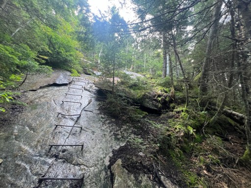
The climb after the Notch up to Fulling Mill Mountain wasn’t too bad, it was a little steep. As I was going up I passed a bunch of other people including two college groups that had ~8 kids in each group. They were all amped up for the notch when I asked them if they were ready for the hardest mile on the AT. I could never imagine my first backpacking experience being the Notch.
I took a break at the shelter and filtered some water and had a snack. It was still fairly early in the morning and I had some descent miles ahead so I could have a short day into Gorham tomorrow.
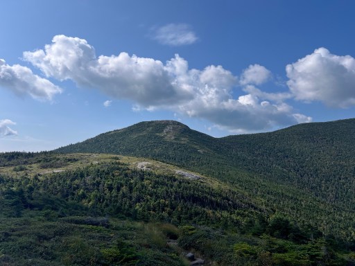
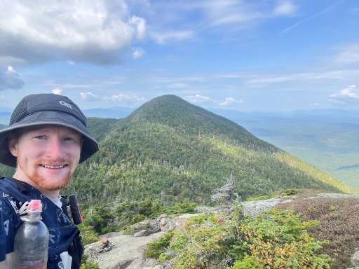
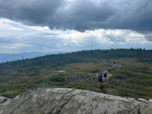
The rest of the day I was mostly ridge walking peak to peak. The views were astonishing and never ending. I went up Goose Eye North Peak, Goose Eye East Peak and Goose Eye West Peak. They got really creative with the names there.
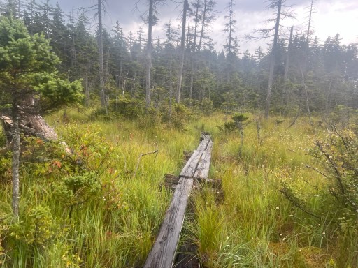
I passed the gentleman and his dog that hiked through the Notch last year. He said his dog had to get stitch up on his belly after the hike. I could see them in the distance crossing a bog board as I climbed up Goose Eye East Peak.
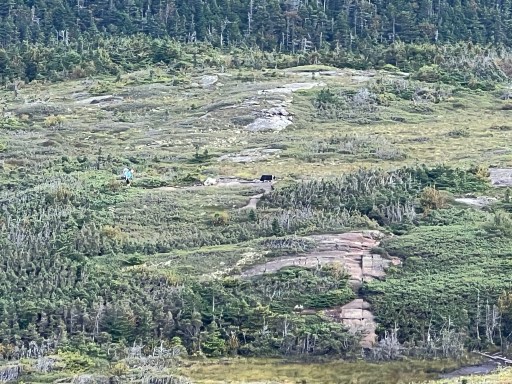
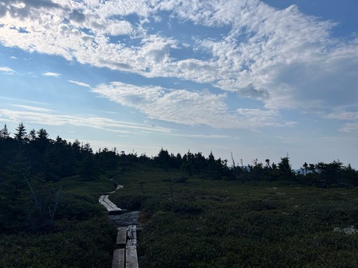
There were tons of bog boards today. There were a few that appeared to be walkable but were floating and would sink into the bog if you stepped in them. My trekking poles really came in handy in these sections. I would trudge along poking at each board before I walked across.
After those peaks I had some more ridge walking to do. Lots of smaller up and downs today. The trail is extra rocky and rooty. On one of the descents I was what seemed to be a large squirrel scurry across the trail and up a tree but it was a mink! I couldn’t get a good picture of it but if you look closely you can see his face hidden in the branches.

I ate lunch on some ledges. Just before the ledges there was a steep section that reminded me of the notch this morning. I could hear a group of hikers in the distance as I ate. It turns out there’s a group of 7 day hikers that are hiking 30 miles today. They started bright and early at 3:15am this morning are hiking some of the most technical terrain of the AT.
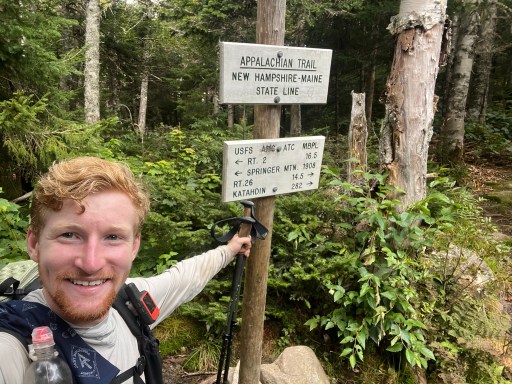
Just .6 away from where I ate lunch I passed the ME/NH boarder. I missed it and walked back .1 miles to take a picture next to it. I guess I was focused on not stepping into the mud pit that was in front of it. One state down 13 more to go!
The next mountain was Mt Success. I caught up to the group of day hikers here. They seem to be moving at about the same pace as I am. There are not many signs that have the names of the mountains anymore here in NH.
Over the next few miles I would pass and get passed my the group of hikers. They had lots of energy considering how long they’ve been up for. They are from the NH area and all meet on a hiker Facebook group.
About 5 miles away from camp it started to rain. I was enjoying my dry feet the last two days and they are now drenched again. The rain brings cooler air temperature and puts a little more pep in my step. I continued to cross a bunch of boggy areas this afternoon.
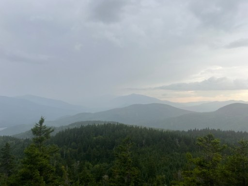
There was a little bit of thunder and it seemed to be further away. I think we’re just getting the edge of the storm and the rain would go from light to heavy for a few seconds at a time. Evan though it was raining the views were still fairly clear. I got a view towards the presidential range from Wocket Ledge.
Page Pond was also a pretty sighting in the rain.

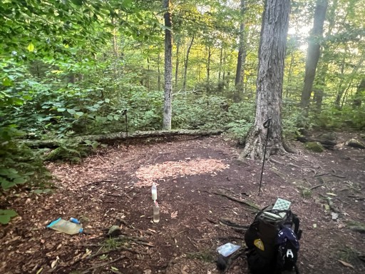
Camp for the night is at Trident Col campsite. I’m setup in the furthest campsite back as I was one of the last hikers here today. Most have come just a few miles from Gorham. Planning on getting up fairly early to hike into Gorham tomorrow for a resupply.

Leave a comment