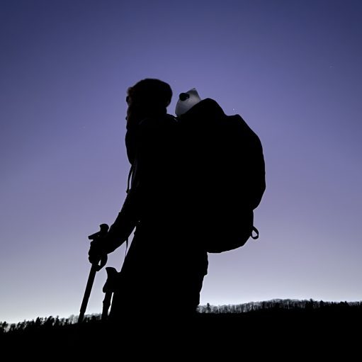
Date Written: 11/09/2024 | AT Mile 1648.6 | Day Total: 21.3 miles | Gain: 4428 ft
Woke up to my alarm and packed up my sleep system before heading to the picnic table outside for breakfast. Slept okay, the mice scurried throughout the whole shelter last night. I enjoyed the beautiful sunrise while I ate some coco wheats, a poptart and an Ensure coffee mixture.

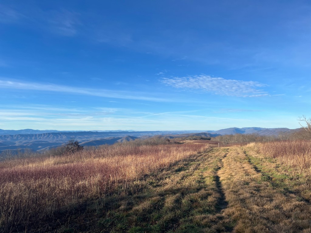
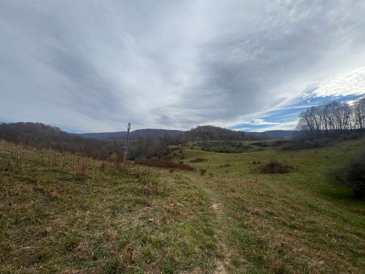
I left the shelter just before 8 and briefly walk through wooded section of trail. The next two miles after I had some of the best views! The grassy field had wonderful and vast views to my left.

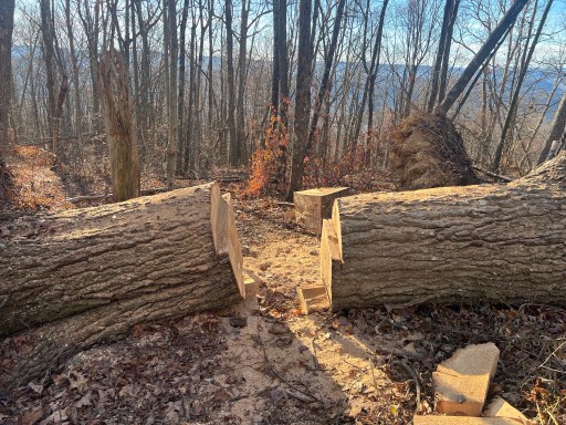
A small pond neared the end of the beautiful ridge walk. As I descended to VA Route 625 I saw a ton of freshly cut blowdowns. Some were massive, upwards of 3ft in diameter. I’m surprised they had a chain saw capable of such large cuts.


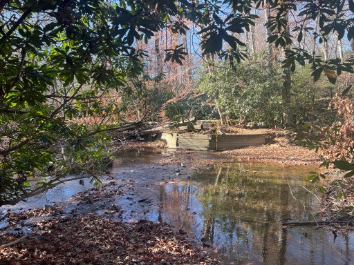
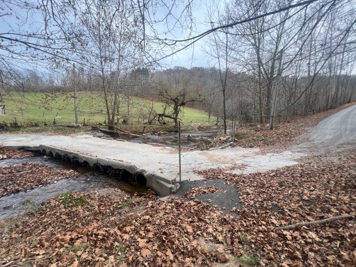
After reaching VA Route 625 I crossed Lick Creek. The bridge was washed out years ago and is now needed to be ford. Luckily with the dry weather lately I was able to get across dry with good balance and foot placement on rocks.
Just in the other side of the Creek, they’re a bunch of blow downs, and it was difficult to find the trail again. After a few minutes of wandering a used FarOut and was able to find the trail.
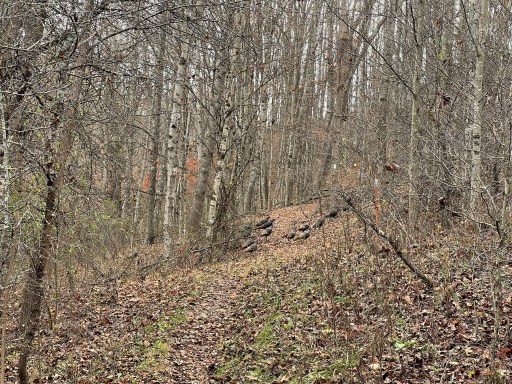
During my climb up a small 800 foot mountain, I passed a group of ~10 Boy Scouts accompanied by 4 adults. The mountain wasn’t too steep, but on the way down there was a root ball that had lifted a large chunk of the trail. The trail was on a steep and hard to grip slope even with my grippy shoes. My hiking poles came in handy.

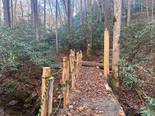
I eventually made it to Lynn Camp Creek. Although it’s pretty early still, I decided to do lunch here and filter water. The bridge has been recently reinforced and a new railing has been added.
After lunch, I climbed up another mountain past Knot Maul Branch shelter. There was one really big blow down at the top that the trail had to be moved around.

After this mountain I walked down to VA 42. There were a bunch of cars and trucks in the parking lot, presumably from the group of Boy Scouts I saw earlier. I bumped along a few hills before reaching a section of pastures with good views. They spoil the cows here. There are also a few ladders that went over the barbed wire fences.
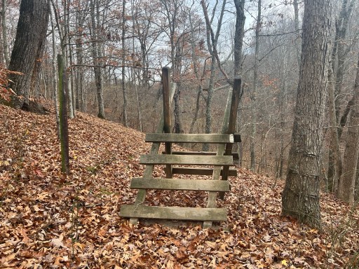
Not long before I crossed the North Fork of Holston River I watched a group of 20 turkeys cross the trail. This was followed by the tallest barbed wire fence ladder I’ve seen.

After a 450 ft climb, I walked through more pastures. There was a group of hunters in blaze orange resting on their way up the field. They said they’ve had no luck today and ask if I had seen any deer recently. I said no but told them I saw a group of turkey a mile or so back.
Once I was rejoined in the forest again I climb another 800 ft. There was a small view looking back at the pastures midway up. I had a packs off snack break at the top and determined that I would stay at the campsite at Reed Creek.

As I made my way down I ran into 2 trail maintainers that own Woodshole Hostel. One of which was balancing a chainsaw on her shoulder. They had been clearing the trail today and gave me some insight on the closures ahead. I’ve been seeing comments from the “Handsaw Boys” on FarOut and from the sounds of it they are road walking the closed section of trail. It also happens that the sobo hiker I’ve been following on Mapshare (Remi Curren) is part of that group now. He posts video updates but they are pretty far behind but his mapshare has given me an idea of how hikers are getting through.
Another 4 crew volunteers followed the two I had talked with. I talked with them briefly and thanked them for all the work they’ve been doing. One of them said it took 4 days to clear the trail from VA Route 625 to Chestnut Knob shelter. I could very well see why as there were a boat load of blowdowns there that were freshly cut.

After reaching the creek I decided to move on. I would like to be on the ridge where I have service tonight so I can do some research for a meeting I have coming up. After a 800ft climb I came across some undesirable campsites and continued onto some that were marked on FarOut. While I was on the ridge I had an amazing view as the sun got closer to the horizon.

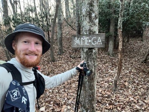
With going a bit further to Davis Path Campsite it also means that I’ll pass the 3/4 mark!!! This last 1/4 is going to be an interesting one.
I set up my tent and cooked up some dinner. I went to hang my food bag and in the process my carabiner released my bag causing my line to get caught in the tree. I was attempting a pct hang and it appears to have slip knotted itself around the branch. I spent a few minutes attempting to free it in the dark but decided to worry about it in the morning and hung the bag with the remaining line.
I headed back to my tent, spent some time online, journaled and went to bed. Plan for tomorrow is to get it the shelter (Partnership Shelter) right at the road into Marion.

Leave a comment