

Date Written: 11/19/2024 | AT Mile 1783.4 | Day Total: 14.7 miles | Gain: 4527 ft
Slept well last night. I woke up before my alarm went off this morning and put my contacts in before heading to the common house where they had coffee and cereal. One of my staples when I’m in town and resupplying is grabbing a banana or two. Fresh fruit is the best. I talked with two Sobos that had just finished their hike while I ate by the fire pit. They skipped this section and came back once they were done to volunteer!
Fueled up for the day I headed back to the bunkhouse and packed my bag and organized all my gear. I’ve got tons of food, enough for 5 days, my bag has never felt this heavy since the 100 mile wilderness.
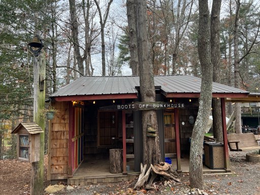
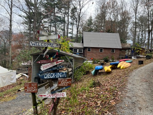
I brought the basket of linens back to the common house and checked out. I began the short walk off the beautiful property and back onto the trail.
The trail should be clear from here ~10 miles south to Dennis Cove Road. I’ve never appreciated a clear trail as much as I do now having gone through some rough blowdowns.
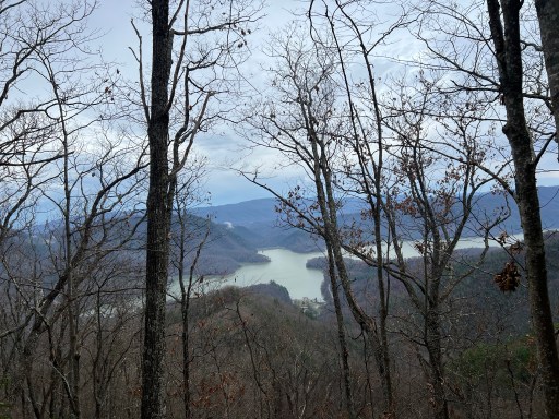
Right off the bat I climbed 1800ft up a mountain. While I luged myself and my heavy bag up I had views of Watauga Lake below. I was even able to make out the dam that I had walk over 8 miles ago.
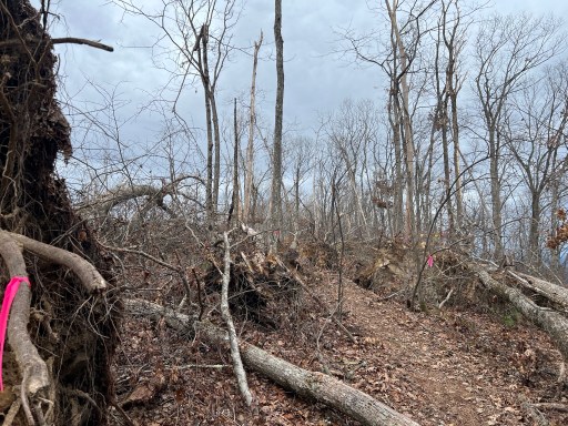
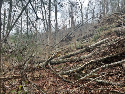
As they mentioned at Boots Off there’s a large reroute at the top marked with pink flagging tape. It through a mostly cleared path through a field of blowdowns. There were still some large trees that were easy to squat and climb over I assume because they were too large for the saw to cut.
After the reroute I immediately began walking back down what I had just climbed up. There were sections of rhododendron tunnels along the switchbacks down.
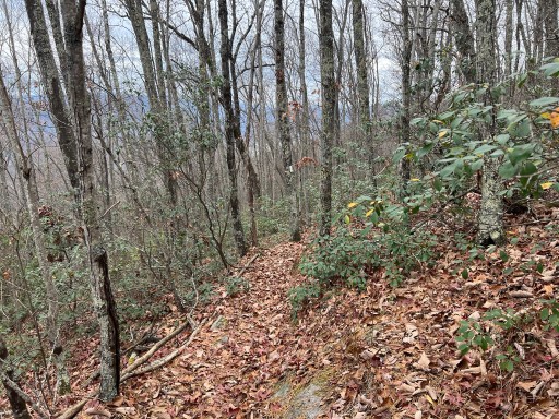
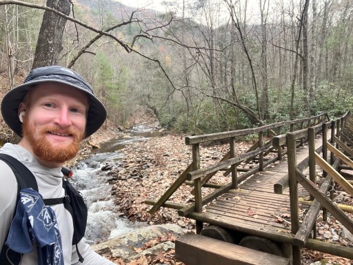
At the bottom I reached Laurel Fork and crossed it over a bridge, not once but twice.
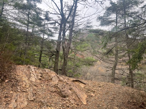
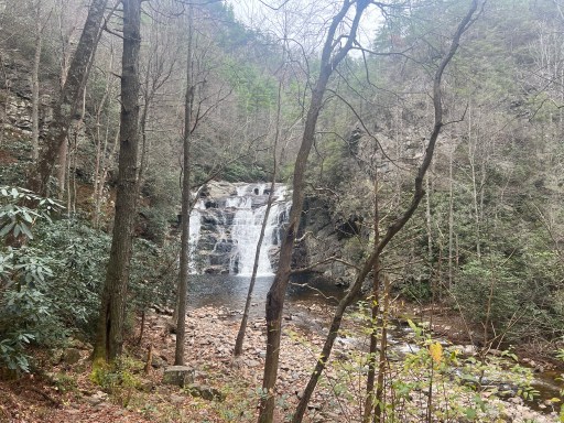
As I approached the falls I was walking on desert like stone and rock. Or it at least had the same shade as rocks in the desert or dry climate would.
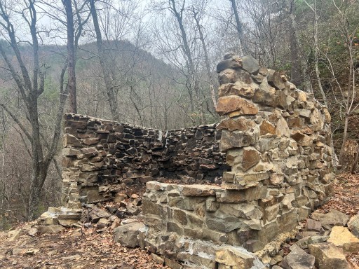
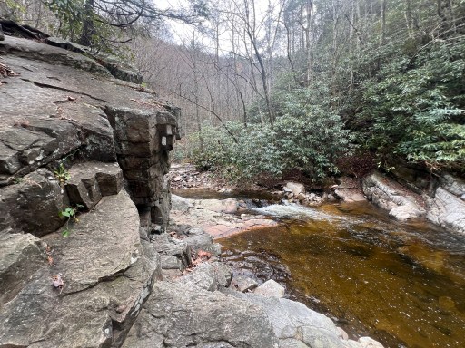
Just before I reached the falls I passed the spur trail that heads to Laurel Fork Shelter. I’ve seen signs stating that it burned down in August so I decided to check it out for myself. All that was left was the 3 sided stone walls blackened from the fire. The surrounding area was not burned at all.
Some neat trail as I walked along the water up to the falls. The trail boarderd the “shoreline” along some boulders.
I reached the falls and stoped for lunch on the steps. They were much larger than I had expected and roaring through the valley as I had approached it.
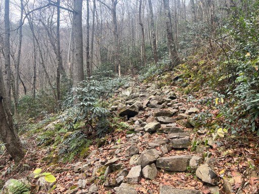
After my lunch break I went up rock stairs for 300ft of ascent. This was exhausting.
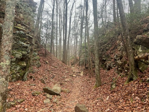
Some more near trail after the stairs. It flattened out for a bit and walked through a ravine of sorts.
I crossed over Laurel Fork for the last time and made it to Dennis Cove Road. I filtered water here before I made another massive climb. Just as I began climbing I passed by a rotten cabin. Definitely no longer waterproof.

As I made my way up I ran into some consistent medium difficulty blowdowns to get around. At one point I had to cut a large switchback to avoid a field of blowdowns. Had some really good view along the way.
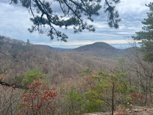

At the top I was able to see Roan Mountain! I’ll be there on probably 2 days time. Depends on how fast I’m able to get having to navigate through these blowdowns.

I took a break at a campsite and spring in the saddle before I reached the shelter. The spring at the shelters unreliable so I’m carry water there from here.
Blowdowns got pretty bad the last 2 miles before the shelter. Slowed me down quite a bit. There was a field and they were pretty consistent every few yards to the shelter. I arrived at 5:15, just before sunset. The shelter, like a recent FarOut comments suggests, is totally demolished. Multiple blowdowns have fallen right on top of it. The roof is completely collapsed.

I pitched my tent nearby in some flat ground. I did my usual routine.
I’ve lucked out today. It was supposed to be spotty rain all day but I haven’t seen a drop! It’s calling for some late tonight and shattered showers tomorrow though.

Leave a reply to bravelyd4b627cd25 Cancel reply