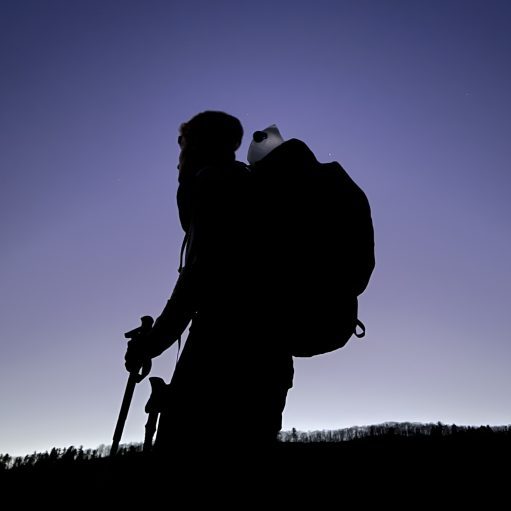

Date Written: 11/16/2024 | AT Mile 1738.1 | Day Total: 11.7 miles | Gain: 3144 ft
Woke up before my 7am alarm. Breakfast is made at 7:30 by Lady Di. I packed up a little before I headed down. Downstairs I poured a cup of coffee and went into the dining room. She had a feast for me and the two other bikers that are here! Top 3 breakfasts I’ve had on trail! Coffee, smoothie, omelet/egg mix, potatoes, bacon, toast! Delicious!

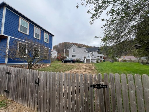
After breakfast I headed over to the grocery store. It’s a little over a mile away but Lady Di has bikes and small backpacks with coupon codes to use. She’s thought of everything!
Once back from the store I organized and packed everything up. I’m going to try and get a handsaw from one of the outfitters on town on my way out. I’m probably going to venture into blowdown mania here soon and a handsaw can help clear a little path.
I stopped into the open outfitter in town and a picked up a handsaw. I asked if she knew any updates on the trail south of here and she said they may have cleared it to the VA/TN boarder!
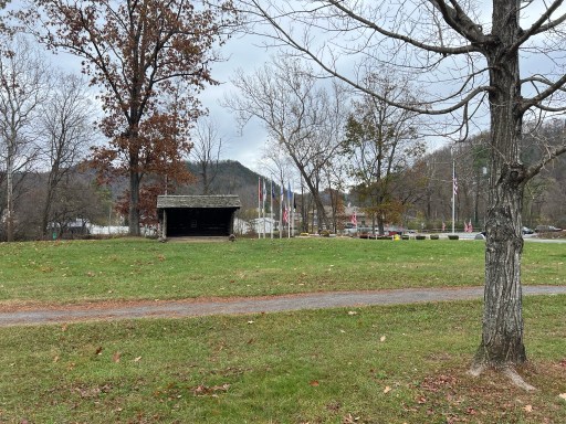
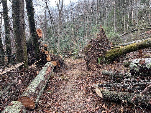
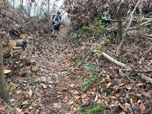
Hopes up, I continued through town and past the library with a AT shelter in the yard. The trail turned into a residential road then I could see where the trail entered the woods. It was not taped off like the one at elk garden. Not like that was going to stop me… The trail indeed was cleared! And what a mess it was. The first half mile was complete blowdown fields. I’m shocked that they were able to find the old trail in this mess they had to cut a switchback short because of a massive rootball.
The trail out of town wasn’t too steep. Today’s weather is perfect, I’m in shorts, temperature is wonderful and it’s overcast.
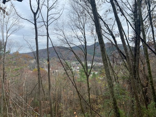
With all the blowdowns I’m able to see Damascus pretty well through the trees. I could even single out Lady Di’s.
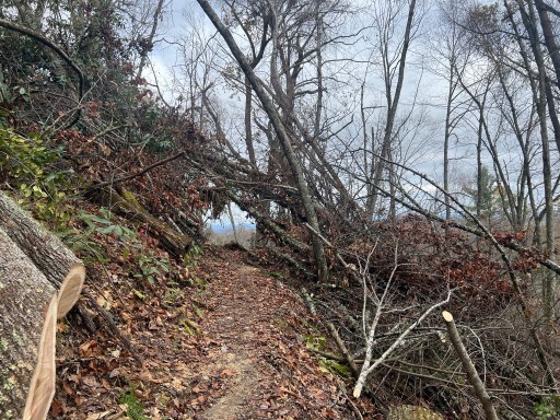
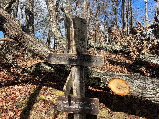
The cut blowdowns weren’t as frequent as I got closer to the TN/VA boarder. I’ve been in Virginia for a longtime, it’s time for a new state! A large branch split the sign but it’s still legible.
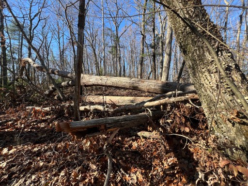
After the state line the trail was no longer cleared. At this point I whipped out my handsaw and got my hands dirty. I’m able to cut branches as big as 4 inches diameter but if there and bunch I just walked around them. I would be out here for days with this thing if I were to do it with just an handsaw. My main purpose was to clear a path.
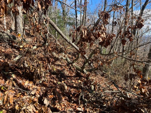
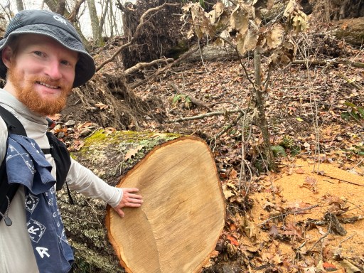
It wasn’t long before I ran into a ~200 yard wide blowdown field. I spent a good 10 minutes navigating off trail and trying to get to the other side. I walked along a massive 4ft diameter tree.
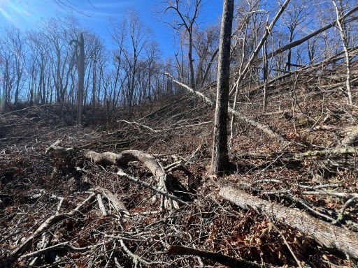
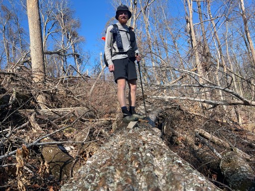
After the fields of blowdown I continued hiking and every few yards I would encounter another blowdown. Most were easy to walk over or under but some I had to take small detours around.
Had some unofficial views of the valley below once I was on the ridge. I ended up having a late lunch at 1. My breakfast kept me full for a while. I threw my tent out in the sun as it didn’t completely dry last night in the porch.

After lunch I continued down the trail and around the blowdowns. I probably made around 200+ cuts with my saw today. Some small others big. I’m careful, especially around the airborne trees, to not cut any branch under tension or pressure that could cause a collapse near me.
Once I was 2.8 miles from McQueens Gap Road the trail was cleared once again! I was able to put down some easy miles again. Before I reached McQueens Gap I stopped at Abingdon Gap Shelter to grab water. It’s .2 down the mountain. There were a few blowdowns I had to go over and under to reach the source. Unfortunately the pipe is not flowing and after searching around a bit I was able to dig out some rocks and leaves and get a trickle to pull water from.
After 40 minutes I was back at the shelter with enough water for tonight. I’m going to continue on past the gap and hopefully camp near McQueens Knob Shelter.

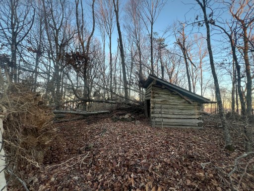
Unfortunately the trail hadn’t been cleared sobo of McQueens Gap. I continued onward to the shelter and nearly missed it because it was surrounded by blowdowns. It appears to be undamaged but a branch is on the roof and a root ball is a few feet from the front. All the campsites here were covered by other blowdowns.
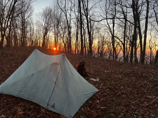
I hiked .1 past the shelter and found an okay spot for my tent. Not the flattest but it’ll work. The sun was setting in the horizon while I’m I setup camp.
I made some dinner and posted a bunch of comments on FarOut. Nobody has put any comments about trail conditions here.

Leave a reply to egcc93 Cancel reply